AUTOMATED WORKSTATION OF A HYDROLOGIST-ANALYST
GIS Meteo Hydro software allows you to solve the following tasks:
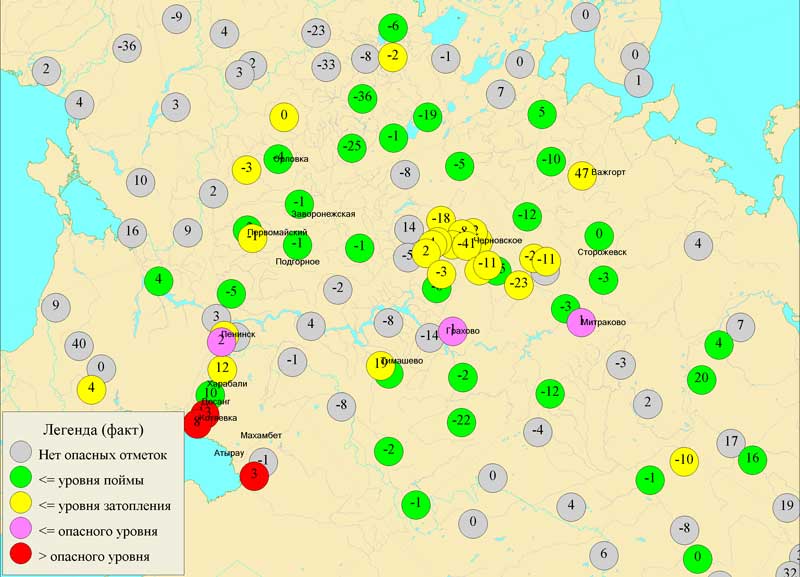
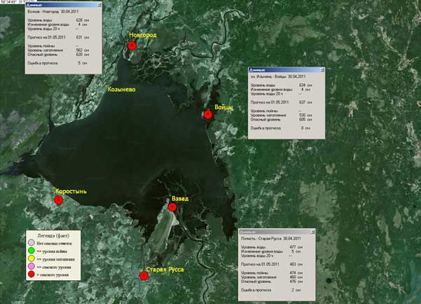
- Rivers and reservoirs monitoring
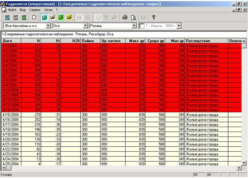
- Ordering of hydrological data
- Snow cover monitoring in forests and agricultural areas
- Logging of hydrological forecasts
- Advice and help information on the hydrology regime for different industries (energy, water transport).
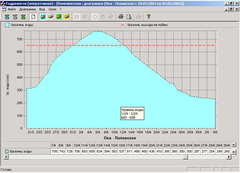
FORECASTS
Automated workstation of a hydrologist analyst forecasts:
- The values of flow rate and the volume of runoff
- The influx of water in reservoirs
- Time of onset of the characteristic phenomena of the water regime and the onset of ice phenomena
- The thickness of the ice
- The limit values of hydrological phenomena
Long-term forecasts
Prediction of hydrological phenomena
- Forecasting of flash floods and of flooding of floodplains
- Analysis of flood events
- Forecasts of the height of wind waves on lakes and reservoirs
FEATURES
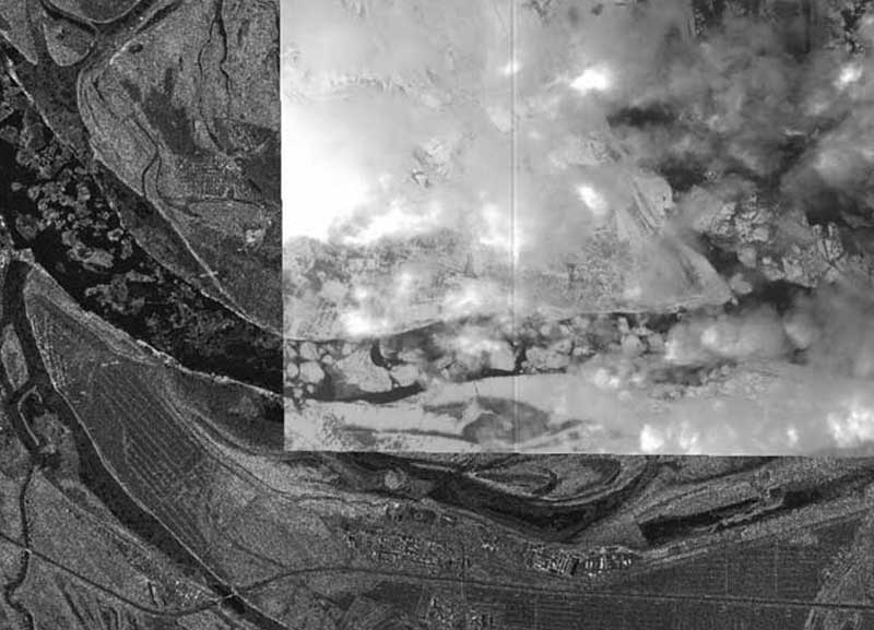
Some featuresSatellite images
GIS Meteo HYDRO software can be provided with satellite RADAR SAT imagery of the Earth's surface (snow, ice conditions in the water bodies of land), HRPT and TERRA / MODIS imagery.
DATABASE
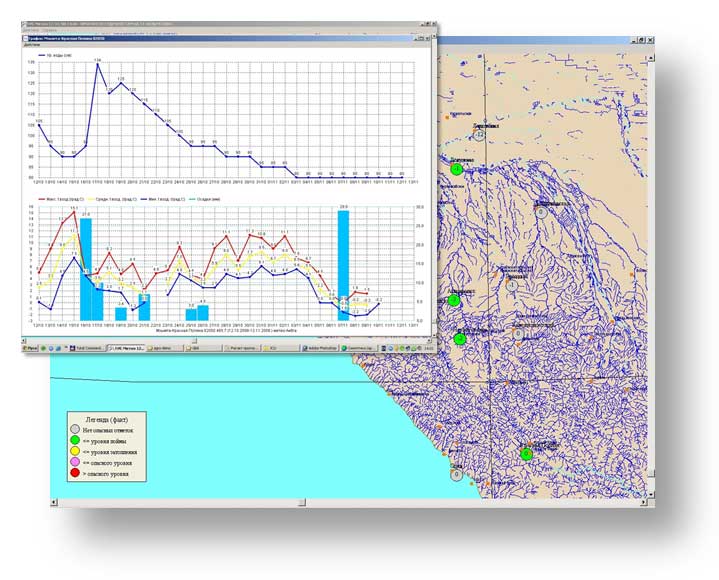
Local database contains current information of hydrological gauging stations for the last five days, and a relational database from all hydro-meteorological and agro-meteorological stations of a serviced area for the current year and an archive of the past including numerous normative data.
MODEL CALCULATIONS
An automated workstation of a hydrologist-analyst provides the ability to use model calculations within servICed local water bodies.
INTERACTION WITH an automated workstation of a meteorologist-analyst
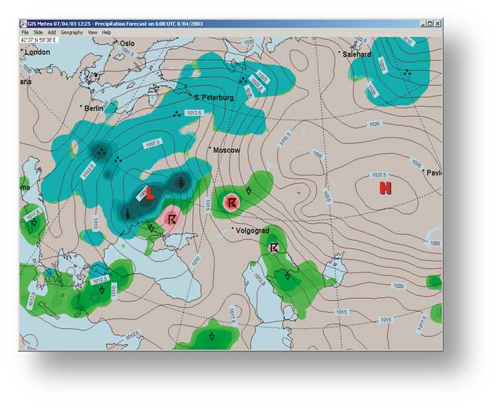
As hydrology forecasters need maps of surface analysis, maps of air temperature and precipitation of a different time length, please install a meteorologist’s software.